
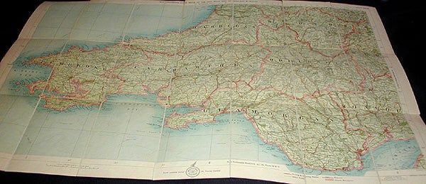
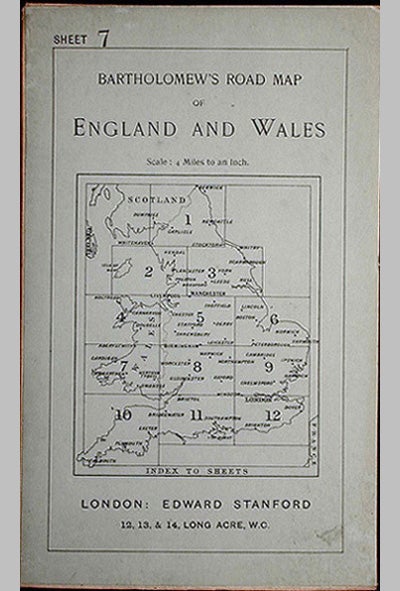
Bartholomew's Four Miles To the Inch Road Map of England and Wales: New Series Sheet 7: Southern Wales
London, Eng. Edward Stanford, 1900. The Edinburgh Geographical Institute; Copyright John Bartholomew & Co. 1 sheet 53 x 76 cm. Color map, dissected and mounted on linen. Light blue paper attached to front and back, when folded, printed in black. Cover title: Bartholomew's Road Map of England and Wales. Small printed label for Edward Stanford, "Geographer to the King," attached to map in lower right-hand corner next to copyright notice of John Bartholomew & Co. Lower caption notes: "Roads specially revised for Touring Cyclists." No date of publication. Bartholomew's Four Miles To the Inch Road Maps were advertised in 1897 and into the 20th century. This map does not contain the publisher's dating code or the Cyclists' Touring Club symbol (both used from 1911) or road numbers (used from 1921). This suggests that it was published around 1900. The map shows the southern part of Wales, containing Pembroke, Carmarthen, Cardigan, Radnor, Brecknock, Glamorgan, and parts of Monmouth and Hereford. In Very Good+ Condition: covers are somewhat soiled, but intact; two linen folds (out of six) just starting to separate from the top edge; otherwise a clean and solid map. An attractive copy of this scarce map from the turn of the last century showing routes appropriate for drivers and cyclists. Very Good +. Item #000485
Price: $24.00