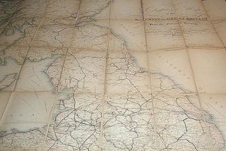
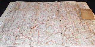
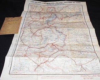
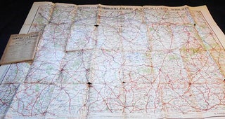
Bartholomew's "Half-Inch to Mile" Map of England & Wales: Sheet 8 Merseyside [Liverpool to Manchester]
Edinburgh: John Bartholomew, 1926. Paperback. "Scale: 2 Miles to an Inch." 1 folded color map (76 x 57 cm.), linen-backed; green paper front and back when folded. Hugh Rees, London, bookseller, on front and back. No date of publication; code in upper left-hand corner of map is "A26" meaning printed..... More


![Item #004430 Les Isles Britanniques [map]. Louis Brion de La Tour](https://classicbooksandephemera.cdn.bibliopolis.com/pictures/004430.jpg?width=320&height=427&fit=bounds&auto=webp&v=1472068391)